
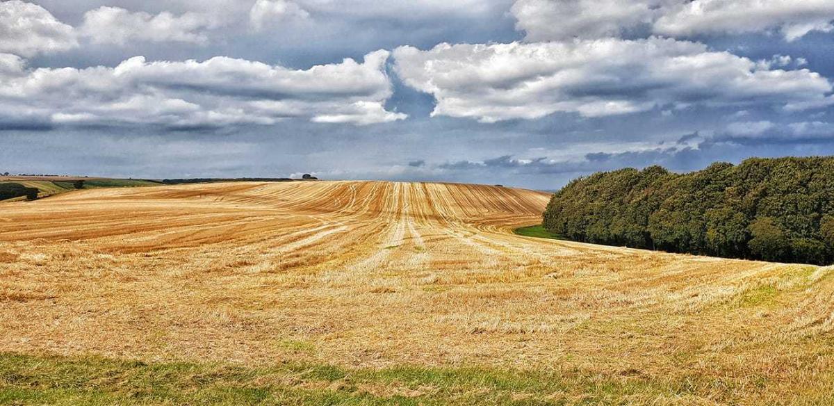
THE latest walk in our series of routes supplied by Swindon Ramblers is a picturesque one taking in Chiseldon and the Ridgeway.
It includes a section of track once used by the firm described as Swindon’s other railway company.
Distance: Six miles
OS Maps: Explorer 157 Landranger 173 and 174
Start: There is a car park at the Chiseldon end of the Chiseldon to Marlborough Railway Path (SU192793).
From Junction 15 of the M4 take the A346 towards Marlborough. Turn right at the minor crossroads beyond the filling station in Chiseldon. The car park is on the left, past the farm shop.
Swindon to Marlborough bus services X5 (Monday to Saturday) and 80 (daily) stop near the petrol station.
Directions:
1 From the car park - the nearby farm shop is an ideal refreshment stop either now or when you have worked up an appetite - follow the Railway Path in the direction signposted Marlborough and Newbury. The path runs parallel with the A346, which is one field away to the left. Beyond the road the land rises to a ridge on the skyline which will be walked on later. The Swindon, Marlborough and Andover Railway was opened in 1881. It later became part of the Midland and South West Junction Railway. The line was closed in 1961. One of its most important stops was Old Town.
2 After about a mile the track bears left to go around a bank on the right. Continue to tarmac road and turn right. After 40 yards turn left and continue walking along the Railway Path for another two thirds of a mile, when the path dips down to a concrete track with a derelict brick bridge on the right.
3 Turn left to the main road and cross it carefully - the traffic is very fast here. Turn right and walk along the grass verge, passing the double gates across a drive. After another 60 yards along the verge, climb up the grass bank on to the tarmac track and walk up the hill towards the radio mast. Continue along the grass track to reach a low gray structure on the right.
4 Turn left along the Ridgeway Path and follow the wide mud track - which is firm after dry weather but can hold puddles following rain - until, coming to a wooden signpost at a T-junction.
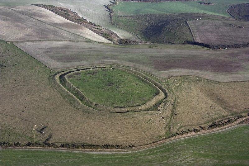
5 At the T-junction turn right and then left, following the Rudgeway sign. At this point if you look down and to the left you will be able to observe the traffic passing along the main road and, beyond, the Railway Path running between hedgerows. Continue until the path forks. Take the left fork and go on until you see a gate across the path. Turn left before this gate and walk down the hill, keeping the fence on the right. About half way down the field go through the gate on the right. A broad grass track lies ahead, keeping near the fence for about 100 yards or so and then bearing left down the hillside until it runs parallel with a fence and hedge on the left. After passing through a gate, look up and to the right to observe Iron Age hill fort Liddington Castle. Its bank and ditch formation are readily visible from this vantage point.
6 Follow the track – ignoring the entrance to a field on the right - which becomes a tarmac road as it bears right. Keep on this road to a T-junction and turn left in order to continue to the A346. The car park from which you set out is across the road on the left.
Swindon Ramblers
Swindon Ramblers have a walk to suit everyone.
Walks include many local tourist attractions, some include the history and heritage of the county, some to spot wildlife, and some for the beauty of the Wiltshire scenery.
The Swindon group was founded in 1950. The leaders are trained in First Aid, and have first class knowledge of the area.
Swindon and the North East Wiltshire Ramblers have a committee that meets once a quarter. The annual subscription to join the Swindon Ramblers is £35.85 for a single and £47.85 per couple.
The money goes to the Ramblers central office for funding. There are three free walks before you are encouraged to join. Everyone is welcome to simply join in one of the walks or visit the website on www. wiltsswindonramblers.org.uk


Comments: Our rules
We want our comments to be a lively and valuable part of our community - a place where readers can debate and engage with the most important local issues. The ability to comment on our stories is a privilege, not a right, however, and that privilege may be withdrawn if it is abused or misused.
Please report any comments that break our rules.
Read the rules hereLast Updated:
Report this comment Cancel